当前位置:网站首页>Talking about GIS Data (5) - Geographic Coordinate System
Talking about GIS Data (5) - Geographic Coordinate System
2022-08-03 04:43:00 【ThingJS_Xiao Nuo】
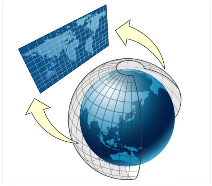
Geographic Coordinate System (GCS)
Geographic coordinate systems are defined by units of angular measurement (Unit), prime meridian (PRIMEM), and datum (DATUM).The coordinate value in the geographic coordinate system is latitude and longitude, so it is sometimes called latitude and longitude coordinate system.CGCS2000, 2000 National Geodetic Coordinate System.We often use WGS84 coordinates directly instead of CGCS2000 coordinates.Because the definition of CGCS2000 is essentially the same as that of WGS84, the reference ellipsoid used is very close.The difference in flattening causes the latitude and height on the ellipsoid to vary by up to 0.1 mm.Within the current measurement accuracy range, this difference can be ignored.

Let's do two small experiments to observe the latitude and longitude coordinates in the CGCS2000 geographic coordinate system.Experiment 1 Is there a big difference between the longitude and latitude obtained in the CGCS2000 coordinate system and the longitude and latitude obtained in the WGS84 coordinate system?It is assumed that the coordinates picked up on Google Map with the satellite basemap as a reference are WGS-84.Since the coordinate system of the sky map is CGCS2000, pick the latitude and longitude of a point on the sky map to observe.Check it out:

"mark" the latitude and longitude of CGCS2000 39.98180450091385 , 116.4546536945034 on Google Map, and compare the two as follows:

The difference is not very large, so in general applications (the positioning accuracy is not high, it doesn't matter if the difference is about 1m) The difference between the CGCS2000 and WGS-84 coordinate systems can be ignored.However, it is different in AutoNavi, because AutoNavi uses the GCJ-02 coordinate system (similar to Tencent Maps), also known as the Mars coordinate system, which is an encryption algorithm for longitude and latitude data.That is, adding random bias.Experiment 2 Download the 1:25w vector data of several regions from Tiantu (National Geographic Information Resource Directory Service System) for observation.Each layer downloaded from the raw data of each tile is a Shapefile file.First look at the .prj file in the Shapefile (the coordinate system for this data is defined in the .prj file).

Select the water system surface data of four different places for comparison, and first superimpose the four surface data on the satellite base map of the sky map.QGIS is used here, the sky map satellite basemap loaded through the XYZ Tiles layer, and then the shp file is superimposed and loaded.


The third map is somewhat offset, and the offset of the coordinate position may be the cause of the original data itself.For example, due to the particularity of the region, the open vector data itself is offset on the basis of the original mapping data, reducing the accuracy.Sometimes, the third-party tile data itself is not processed as "consistent" at different levels (scales).
Summary:
1. Two common geographic coordinate systems

my country has fully implemented the use of the 2000 National Geodetic Coordinate System.In applications where the positioning accuracy is not high (the difference of 1m does not matter), it can be considered that there is no difference between CGCS2000 and WGS-84.
2. The coordinate systems used by each Internet map have been offset according to national laws and regulations

3. The longitude and latitude coordinates are superimposed on the map basemap and offset (1) Generally, it is caused by the mismatch between the longitude and latitude coordinate system and the coordinate system of the map basemap.In this case, it can be handled by converting the latitude and longitude coordinates.(2) If there is still an offset in the same coordinate system, it may be a problem with the original data.
Tool Recommendations
Forest City: One-click generation of 3D cities, with multiple built-in templates, free to edit
• Forest City currently provides standards for more than 110 cities nationwideThe 3D scene construction service enables the construction speed of urban 3D scene to be increased to the minute level.
• Mori City supports the insertion and automatic fusion of different types of urban data, and provides friendly and powerful scene editing capabilities and performance processing capabilities. No professional skills such as GIS and modeling are required.Easily DIY your own cool city 3D scene.
• Mori City has an open city scene output capability, so there is no need to worry about the compatibility issues of subsequent use of the scene.
Low-code ThingJS: low-code flexible development of digital twin visualization applications
• Low-code ThingJS provides rich 3D development APIs, complete development documents and video tutorials. Familiar with basic JavaScript front-end knowledge can start digital twin 3D visualization application development.
• Low-code ThingJS is a pure H5 WebGL architecture, which can run freely in all kinds of mainstream web browsers, including direct access and running on mobile terminals.
• Low-code ThingJS provides full-lifecycle development components, greatly improving the development efficiency of digital twin visualization projects.
边栏推荐
猜你喜欢

【生物素叠氮化物|cas:908007-17-0】价格_厂家
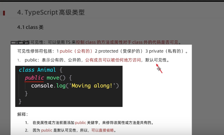
typescript39-class类的可见修饰符

Kotlin-Flow common encapsulation class: the use of StateFlow

修饰生物素DIAZO-生物素-PEG3-DBCO|重氮-生物素-三聚乙二醇-二苯基环辛炔
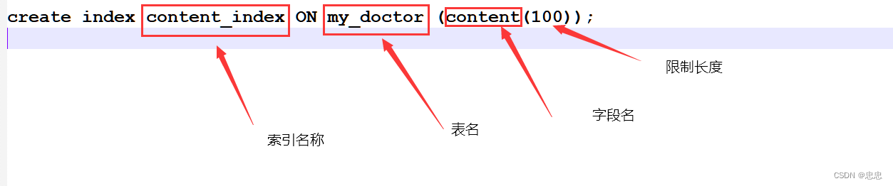
mysql 创建索引的三种方式

移动流量的爆发式增长,社交电商如何选择商业模式
Talking about GIS Data (6) - Projected Coordinate System

荧光标记多肽FITC/AMC/FAM/Rhodamine/TAMRA/Cy3/Cy5/Cy7-Peptide
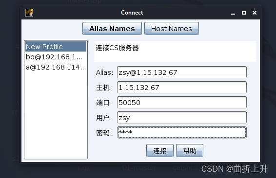
CobalStrike(CS)基础超级详细版

社交电商:流量红利已尽,裂变营销是最低成本的获客之道
随机推荐
接口和协议
C#异步和多线程
typescript49-交叉类型
接口测试框架实战(四)| 搞定 Schema 断言
「短视频+社交电商」营销模式爆发式发展,带来的好处有什么?
测开:项目管理模块-项目curd开发
typescript46-函数之间的类型兼容性
数字化时代,企业如何建立自身的云平台与商业模式的选择?
Live | StarRocks technology insider: low base dictionary global optimization
DFS's complement to pruning
Flink状态
私域流量时代来临,电商企业如何布局?
13.机器学习基础:数据预处理与特征工程
WebSocket的实际应用
测试人员的价值体现在哪里
【生物素叠氮化物|cas:908007-17-0】价格_厂家
接口测试框架实战(二)| 接口请求断言
6.神经网络剖析
Browser listens for tab closing
excerpt from compilation book