当前位置:网站首页>How to make the fixed-point monitoring equipment display the geographic location on the EasyCVR platform GIS electronic map?
How to make the fixed-point monitoring equipment display the geographic location on the EasyCVR platform GIS electronic map?
2022-08-01 18:10:00 【TSINGSEE Green Rhino Video】
We have shared with you about the electronic map function of EasyCVR in the previous article. This function can display the front-end connected equipment (camera, vehicle monitoring, individual soldiers, law enforcement instruments, etc.) on the GIS electronic map in real time.And support clicking on the icon to watch the real-time video surveillance of the current device.Interested users can read our previous articles to learn more.The electronic map function of the EasyCVR platform can also support the drawing of historical driving trajectories and the playback of historical trajectories.
In the previous article, we also introduced the use of electronic maps. We use body-worn recorders, which support real-time collection and real-time upload of location information.For some dome cameras, bolts and other fixed-point cameras or equipment without positioning function, if the user has the need for geographic location positioning, how should the equipment be displayed on the electronic map?Today we will introduce the method.
Because it is a fixed-point camera, in general, it will be installed in a fixed place, and it will not be moved for a long time, so we only need to know the geographic location latitude and longitude information of the location where the camera is installed,Then bind the latitude and longitude information to the device.
About the acquisition of longitude and latitude, you can use the compass APP that comes with your mobile phone or search for a coordinate picker on the Internet to obtain the longitude and latitude information of a specified place.After recording, in the channel configuration of the device, fill in the corresponding latitude and longitude information, and click Modify to save.
Then, on the electronic map interface, click the channel to view the real-time location of the channel.Click the icon to watch the live video surveillance images collected by the device.
The function of the electronic map is very practical. The combination of video surveillance and GIS map can realize the three-dimensional and spatial display of video surveillance data, which can be applied in various scenarios, such as warehouse monitoring, factory monitoring, road monitoring, etc.Wait.
EasyCVR video fusion cloud service platform can support mainstream standard protocols, such as national standard GB28181, RTSP/Onvif, RTMP, etc., and also support manufacturers' private protocols and SDK access, such as Hikvision Ehome, Hikvision SDK, Dahua SDKWait.In terms of device types, it can support multiple types of device access, such as network cameras, DVRs, NVRs, 4G vehicles, 4G handheld individual soldiers and other front-ends, covering most of the video source devices on the market.Interested users can go to the demo platform for experience or deployment testing.
边栏推荐
猜你喜欢
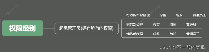
后台管理系统的权限思路
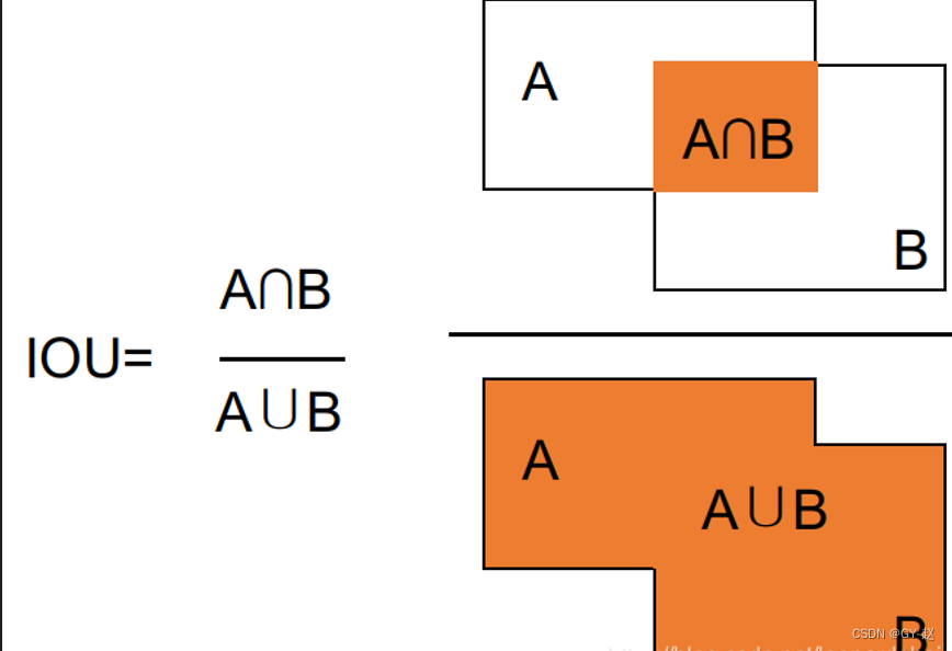
计算IoU(D2L)
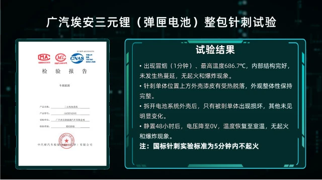
广汽埃安“弹匣电池”,四大核心技术,出行安全保障

RecSys'22|CARCA: Cross-Attention-Aware Context and Attribute Recommendations
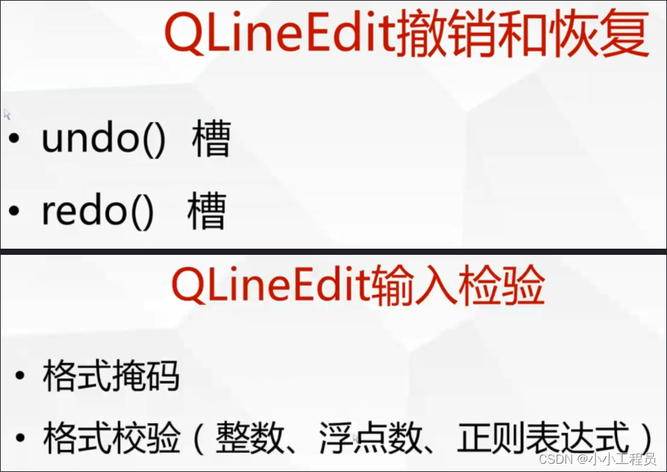
QLineEdit learning and use

生物制药产业发展现状和趋势展望
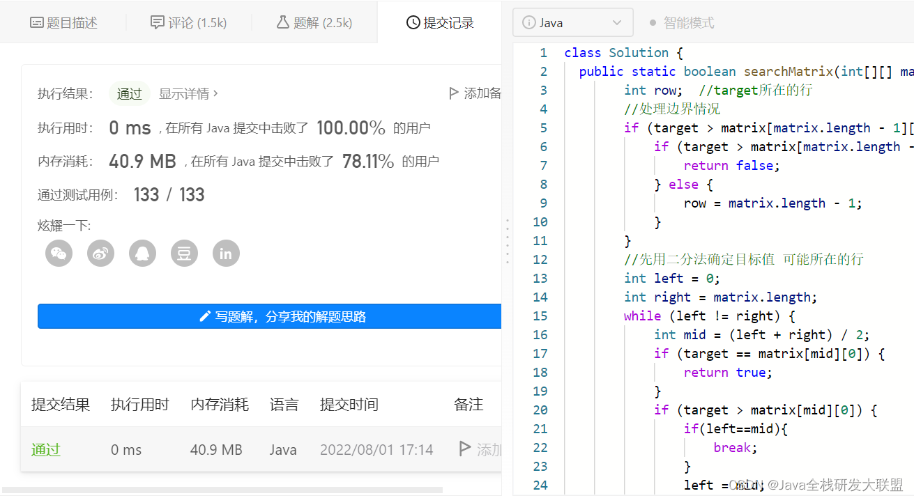
Leetcode74. Search 2D Matrix
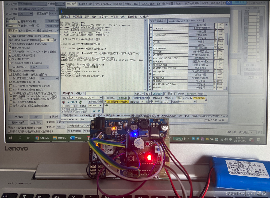
B002 - Embedded Elderly Positioning Tracking Monitor
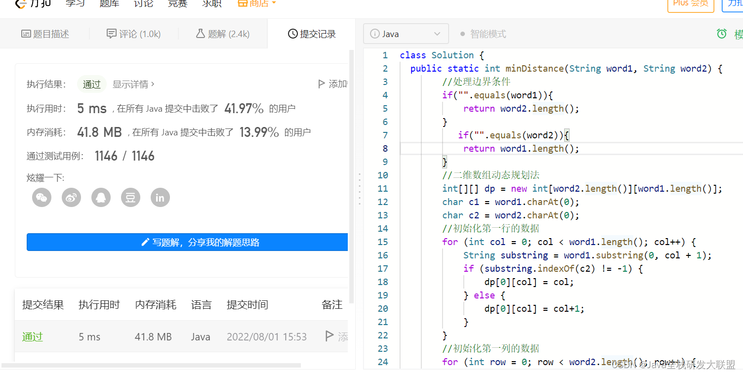
Leetcode72. Edit Distance
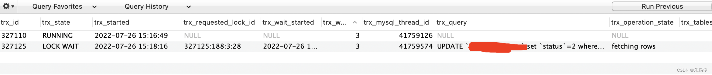
MySQL Lock wait timeout exceeded; try restarting transaction 锁等待
随机推荐
粒子滤波 particle filter —从贝叶斯滤波到粒子滤波——Part-I(贝叶斯滤波)
LeaRun.net快速开发动态表单
浅谈大数据背景下数据库安全保障体系
力扣每日一题-第45天-697. 数组的度
SQL函数 TO_DATE(一)
C language theory--a solid foundation for the written test and interview
DBPack SQL Tracing 功能及数据加密功能详解
Leetcode71. 简化路径
University of California | Inverse Reinforcement Learning from Different Third-Person Videos via Graph Abstraction
B005 – 基于STC8的单片机智能路灯控制系统
一加OnePlus 10RT出现在Geekbench上 产品发布似乎也已临近
opencv基本的图像处理
QT_QThread thread
OpenCV安装、QT、VS配置项目设置
Shell nl命令详解(显示行号、读取文件)
【100个网络运维工作者必须知道的小知识!】
QT_Event class
QPalette palette, frame color fill
QT常用全局宏定义
opencv real-time face detection