39 Repositories
Latest Python Libraries
EODAG is a command line tool and a plugin-oriented Python framework for searching, aggregating results and downloading remote sensed images while offering a unified API for data access regardless of the data provider
EODAG (Earth Observation Data Access Gateway) is a command line tool and a plugin-oriented Python framework for searching, aggregating results and downloading remote sensed images while offering a un
Evaluation of file formats in the context of geo-referenced 3D geometries.
Geo-referenced Geometry File Formats Classic geometry file formats as .obj, .off, .ply, .stl or .dae do not support the utilization of coordinate syst

GetOSM is an OpenStreetMap tile downloader written in Python that is agnostic of GUI frameworks.
GetOSM GetOSM is an OpenStreetMap tile downloader written in Python that is agnostic of GUI frameworks. It is used with tkinter by ProjPicker. Require

ProjPicker (projection picker) is a Python module that allows the user to select all coordinate reference systems (CRSs)
ProjPicker ProjPicker (projection picker) is a Python module that allows the user to select all coordinate reference systems (CRSs) whose extent compl

🗂️ 🔍 Geospatial Data Management and Search API - Django Apps
Geospatial Data API in Django Resonant GeoData (RGD) is a series of Django applications well suited for cataloging and searching annotated geospatial

FPGA: Fast Patch-Free Global Learning Framework for Fully End-to-End Hyperspectral Image Classification
FPGA & FreeNet Fast Patch-Free Global Learning Framework for Fully End-to-End Hyperspectral Image Classification by Zhuo Zheng, Yanfei Zhong, Ailong M

An attempt to map the areas with active conflict in Ukraine using open source twitter data.
Live Action Map (LAM) An attempt to use open source data on Twitter to map areas with active conflict. Right now it is used for the Ukraine-Russia con

Raster Vision is an open source Python framework for building computer vision models on satellite, aerial, and other large imagery sets
Raster Vision is an open source Python framework for building computer vision models on satellite, aerial, and other large imagery sets (including obl

🌐 Local tile server for viewing geospatial raster files with ipyleaflet
🌐 Local Tile Server for Geospatial Rasters Need to visualize a rather large raster (gigabytes) you have locally? This is for you. A Flask application

🌐 Local tile server for viewing geospatial raster files with ipyleaflet or folium
🌐 Local Tile Server for Geospatial Rasters Need to visualize a rather large (gigabytes) raster you have locally? This is for you. A Flask application

A part of HyRiver software stack for handling geospatial data manipulations
Package Description Status PyNHD Navigate and subset NHDPlus (MR and HR) using web services Py3DEP Access topographic data through National Map's 3DEP

🗾 Streamlit Component for rendering kepler.gl maps
streamlit-keplergl 🗾 Streamlit Component for rendering kepler.gl maps in a streamlit app. 🎈 Live Demo 🎈 Installation pip install streamlit-keplergl

Course materials for: Geospatial Data Science
Course materials for: Geospatial Data Science These course materials cover the lectures for the course held for the first time in spring 2022 at IT Un

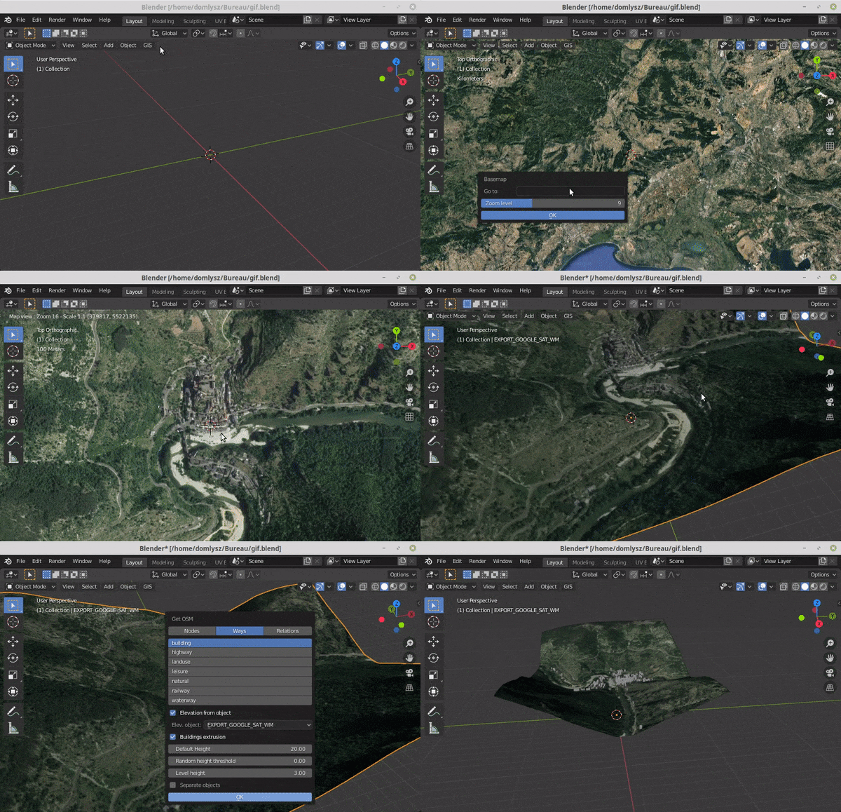
Blender addons to make the bridge between Blender and geographic data
Blender GIS Blender minimal version : 2.8 Mac users warning : currently the addon does not work on Mac with Blender 2.80 to 2.82. Please do not report

Advanced raster and geometry manipulations
buzzard In a nutshell, the buzzard library provides powerful abstractions to manipulate together images and geometries that come from different kind o

Processing and interpolating spatial data with a twist of machine learning
Documentation | Documentation (dev version) | Contact | Part of the Fatiando a Terra project About Verde is a Python library for processing spatial da
🌍 Create 3d-printable STLs from satellite elevation data 🌏
mapa 🌍 Create 3d-printable STLs from satellite elevation data Installation pip install mapa Usage mapa uses numpy and numba under the hood to crunch
OSMnx: Python for street networks. Retrieve, model, analyze, and visualize street networks and other spatial data from OpenStreetMap.
OSMnx OSMnx is a Python package that lets you download geospatial data from OpenStreetMap and model, project, visualize, and analyze real-world street
ArcGIS Python Toolbox for WhiteboxTools
WhiteboxTools-ArcGIS ArcGIS Python Toolbox for WhiteboxTools. This repository is related to the ArcGIS Python Toolbox for WhiteboxTools, which is an A
Earthengine-py-notebooks - A collection of 360+ Jupyter Python notebook examples for using Google Earth Engine with interactive mapping
earthengine-py-notebooks A collection of 360+ Jupyter Python notebook examples for using Google Earth Engine with interactive mapping Contact: Qiushen
Interactive web apps created using geemap and streamlit
geemap-apps Introduction This repo demostrates how to build a multi-page Earth Engine App using streamlit and geemap. You can deploy the app on variou
geemap - A Python package for interactive mapping with Google Earth Engine, ipyleaflet, and ipywidgets.
A Python package for interactive mapping with Google Earth Engine, ipyleaflet, and folium
A multi-page streamlit app for the geospatial community.
A multi-page streamlit app for the geospatial community.
Streamlit-template - A streamlit app template based on streamlit-option-menu
streamlit-template A streamlit app template for geospatial applications based on
WhiteboxTools Python Frontend
whitebox-python Important Note This repository is related to the WhiteboxTools Python Frontend only. You can report issues to this repo if you have pr
An interactive GUI for WhiteboxTools in a Jupyter-based environment
whiteboxgui An interactive GUI for WhiteboxTools in a Jupyter-based environment GitHub repo: https://github.com/giswqs/whiteboxgui Documentation: http
Turn a STAC catalog into a dask-based xarray
StackSTAC Turn a list of STAC items into a 4D xarray DataArray (dims: time, band, y, x), including reprojection to a common grid. The array is a lazy

Manage your XYZ Hub or HERE Data Hub spaces from Python.
XYZ Spaces for Python Manage your XYZ Hub or HERE Data Hub spaces and Interactive Map Layer from Python. FEATURED IN: Online Python Machine Learning C

A collection of modules I have created to programmatically search for/download imagery from live cam feeds across the state of California.
A collection of modules that I have created to programmatically search for/download imagery from all publicly available live cam feeds across the state of California. In no way am I affiliated with a
Python interface to PROJ (cartographic projections and coordinate transformations library)
pyproj Python interface to PROJ (cartographic projections and coordinate transformations library). Documentation Stable: http://pyproj4.github.io/pypr
PySpark bindings for H3, a hierarchical hexagonal geospatial indexing system
h3-pyspark: Uber's H3 Hexagonal Hierarchical Geospatial Indexing System in PySpark PySpark bindings for the H3 core library. For available functions,
3D extension built off of shapely to make working with geospatial/trajectory data easier in python.
PyGeoShape 3D extension to shapely and pyproj to make working with geospatial/trajectory data easier in python. Getting Started Installation pip The e

Simple STAC Catalogs discovery tool.
STAC Catalog Discovery Simple STAC discovery tool. Just paste the STAC Catalog link and press Enter. Details STAC Discovery tool enables discovering d
Satellite imagery for dummies.
felicette Satellite imagery for dummies. What can you do with this tool? TL;DR: Generate JPEG earth imagery from coordinates/location name with public
Python interface to PROJ (cartographic projections and coordinate transformations library)
pyproj Python interface to PROJ (cartographic projections and coordinate transformations library). Documentation Stable: http://pyproj4.github.io/pypr

Streamlit Component for rendering Folium maps
streamlit-folium This Streamlit Component is a work-in-progress to determine what functionality is desirable for a Folium and Streamlit integration. C
Specification for storing geospatial vector data (point, line, polygon) in Parquet
GeoParquet About This repository defines how to store geospatial vector data (point, lines, polygons) in Apache Parquet, a popular columnar storage fo
h3-js provides a JavaScript version of H3, a hexagon-based geospatial indexing system.
h3-js The h3-js library provides a pure-JavaScript version of the H3 Core Library, a hexagon-based geographic grid system. It can be used either in No

A simple python script that, given a location and a date, uses the Nasa Earth API to show a photo taken by the Landsat 8 satellite. The script must be executed on the command-line.
What does it do? Given a location and a date, it uses the Nasa Earth API to show a photo taken by the Landsat 8 satellite. The script must be executed