当前位置:网站首页>ArcGIS for JS API (1) get all field names of FeatureLayer
ArcGIS for JS API (1) get all field names of FeatureLayer
2022-07-27 06:35:00 【LEILEI18A】
Catalog
0. Premise
because search need , Want to search any field , Then you can't write the search field , So explore how to get FeatureLayer All fields of the layer
because JavaScript Recommend asynchronous , therefore .when .then All are Promise The idea of , It can only be handled internally , External due to different threads , So we can't follow the order !!!
Suggest :API edition 4.18 Start !
1. resolvent
【1】 use query Query ideas
//  introduce 2 individual arcgis js The library of
// "esri/rest/query",
// "esri/rest/support/Query"

const params = new Query({
    returnGeometry: false,
    outFields: ["*"],
    where: "1=1" //sql grammar , This is the query all
});

query
.executeQueryJSON("FeatureLayerURL", params) //FeatureLayerURL Need to be URL
.then((getResults) => {
    var fields = getResults.fields;
    console.log(" test ");
    console.log(fields);  // This is to get all the fields array
    console.log(" test ");
})
.catch((error) => {
    console.log(error);
});
【2】 use layer.fields This attribute "." In the form of
//  There is a drawback ,featureLayer Must be included in map Inside !!!
featureLayer.when(function () {
    console.log(featureLayer.fields);
});

//  So get   yes   FALSE ,  Seriously wrong ; Can get layers; But you can't get layer.fields  Only from featureLayer.when obtain
mapView.when(function () {
    console.log(mapView.map.layers.items[i].layers.items[j].fields);
    // Print yourself mapView.map.layers Just look at it
});
【3】** recommend ** use js+arcgis js relation ( union ) The idea of ; This kind of thinking little white knows , Big guys can use , But it is seldom said on the Internet !!
//  because .when .then All are Promise asynchronous , The official example is right Promise<*> The idea is “ call chaining ”, But restrictions , inconvenient ;

// Define asynchronous functions    await Only in async Used in asynchronous functions ; Therefore, the whole process of this operation needs to be in async Function , however arcgis js Support !

async function getFields(featureLayer){
    //  see API,queryFeatures The function returns Promise<FeatureSet>, So you can use await Sync , Call again .fields
    var result = await featureLayer.queryFeatures();
    var fields = result.fields;
    return fields
}

async function test(){
    var fields = await getFields();
    console.log(fields);
}

test();// You need to do this constantly !
The overall code :
<html>

<head>
    <meta charset="utf-8">
    <meta name="viewport" content="initial-scale=1, maximum-scale=1, user-scalable=no">
    <title>ArcGIS API for JavaScript Tutorials: Query a feature layer (spatial)</title>
    <style>
        html,
        body,
        #viewDiv {
            padding: 0;
            margin: 0;
            height: 100%;
            width: 100%;
        }
    </style>
    <link rel="stylesheet" href="https://js.arcgis.com/4.21/esri/themes/light/main.css">

    <script src="https://js.arcgis.com/4.21/"></script>
    <script>
        require([
            "esri/config",
            "esri/Map",
            "esri/views/MapView",
            "esri/widgets/Sketch",
            "esri/layers/GraphicsLayer",
            "esri/layers/FeatureLayer",
            "esri/layers/GroupLayer",
            "esri/widgets/LayerList",
            "esri/widgets/Expand",
            "esri/rest/query",
            "esri/rest/support/Query"
        ], function (esriConfig, Map, MapView, Sketch, GraphicsLayer, FeatureLayer, GroupLayer, LayerList,
            Expand, query, Query) {
            //  It's not necessary
            esriConfig.apiKey =
                "AAPKb6250197a40e497ea9f47f26cf86afad4D7n1PjA_48vNAZ6UDWAHPZwPgvhXXrbTMgdJnXk5c72F3fgInrvB7PZ4r0Gfoy3";
            //  If the display is set popup, So buffer popup Don't show ; If the default is not set popup, however map There are , Also do not show
            const parcelLayer = new FeatureLayer({
                url: "https://services3.arcgis.com/GVgbJbqm8hXASVYi/arcgis/rest/services/LA_County_Parcels/FeatureServer/0",
                visible: false,
            });
            const map = new Map({
                basemap: "arcgis-topographic", //Basemap layer service
                layers: [parcelLayer],  // The first 2 Methods    Must contain ; Otherwise, you can comment out
            });
            const view = new MapView({
                container: "viewDiv",
                map: map,
                center: [-118.80543, 34.03000], //Longitude, latitude
                zoom: 13,
                popup: {
                    defaultPopupTemplateEnabled: true,
                },
            });
            //  The first 2 Kind of   Layer field query method
            parcelLayer.when(function () {
                console.log(" for the first time ");
                console.log(parcelLayer.fields);
                console.log(" for the first time ");
                var tempFields = parcelLayer.fields.map((w)=>{
                    return w.name;
                });
                console.log(tempFields);

            });
            //  The first 1 Kind of   Layer field query method
            const params = new Query({
                returnGeometry: false,
                outFields: ["*"],
                where: "1=1" //sql grammar , This is the query all
            });
            query
            .executeQueryJSON("https://services3.arcgis.com/GVgbJbqm8hXASVYi/arcgis/rest/services/LA_County_Parcels/FeatureServer/0", params)
            .then((getResults) => {
                console.log(" test ");
                console.log(getResults);
                var fields = getResults.fields;
                console.log(" test ");
                console.log(fields);
                console.log(" test ");
            })
            .catch((error) => {
                console.log(error);
            });

            // Add sketch widget
            const graphicsLayerSketch = new GraphicsLayer();
            map.add(graphicsLayerSketch);
            const sketch = new Sketch({
                layer: graphicsLayerSketch,
                view: view,
                creationMode: "update" // Auto-select
            });
            view.ui.add(sketch, "top-right");
            // Add sketch events to listen for and execute query
            sketch.on("update", (event) => {
                // Create
                if (event.state === "start") {
                    queryFeaturelayer(event.graphics[0].geometry);
                }
                if (event.state === "complete") {
                    graphicsLayerSketch.remove(event.graphics[
                        0]); // Clear the graphic when a user clicks off of it or sketches new one
                    // view.graphics.removeAll();
                }
                // Change
                if (event.toolEventInfo && (event.toolEventInfo.type === "scale-stop" || event
                        .toolEventInfo.type === "reshape-stop" || event.toolEventInfo.type ===
                        "move-stop")) {
                    queryFeaturelayer(event.graphics[0].geometry);
                }

            });


            // Reference query layer
            // const parcelLayer = new FeatureLayer({
            //     url: "https://services3.arcgis.com/GVgbJbqm8hXASVYi/arcgis/rest/services/LA_County_Parcels/FeatureServer/0",
            // });
            function queryFeaturelayer(geometry) {
                const parcelQuery = {
                    spatialRelationship: "intersects", // Relationship operation to apply
                    geometry: geometry, // The sketch feature geometry
                    outFields: ["APN", "UseType", "TaxRateCity", "Roll_LandValue"], // Attributes to return
                    returnGeometry: true
                };
                parcelLayer.queryFeatures(parcelQuery)
                    .then((results) => {
                        console.log("Feature count: " + results.features.length)
                        displayResults(results);
                    }).catch((error) => {
                        console.log(error);
                    });
            }
            // Show features (graphics)
            function displayResults(results) {
                // Create a blue polygon
                const symbol = {
                    type: "simple-fill",
                    color: [20, 130, 200, 0.5],
                    outline: {
                        color: "white",
                        width: .5
                    },
                };
                const popupTemplate = {
                    title: "Parcel {APN}",
                    content: "Type: {UseType} <br> Land value: {Roll_LandValue} <br> Tax Rate City: {TaxRateCity}"
                };
                // Set symbol and popup
                results.features.map((feature) => {
                    feature.symbol = symbol;
                    feature.popupTemplate = popupTemplate;
                    return feature;
                });
                // Clear display
                view.popup.close();
                view.graphics.removeAll();
                // Add features to graphics layer
                view.graphics.addMany(results.features);
            }

            view.when(function () {
                const layerList = new LayerList({
                    view: view,
                });
                var expandLayer = new Expand({
                    view: view,
                    content: layerList,
                    expandIconClass: "esri-icon-layers",
                });
                view.ui.add(expandLayer, "top-right");

                console.log(" The second time ")
                console.log(parcelLayer.fields);
            });

        });
    </script>
</head>

<body>
    <div id="viewDiv"></div>
</body>

</html>
2. thank
Thank you very much. “280120168” This arcgis-js Help of the group !
边栏推荐
猜你喜欢

Interpretation of unity desktop version 7.6
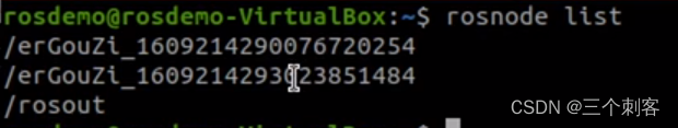
Advanced ROS communication mechanism
Unity engine starts to migrate from mono to.Net coreclr
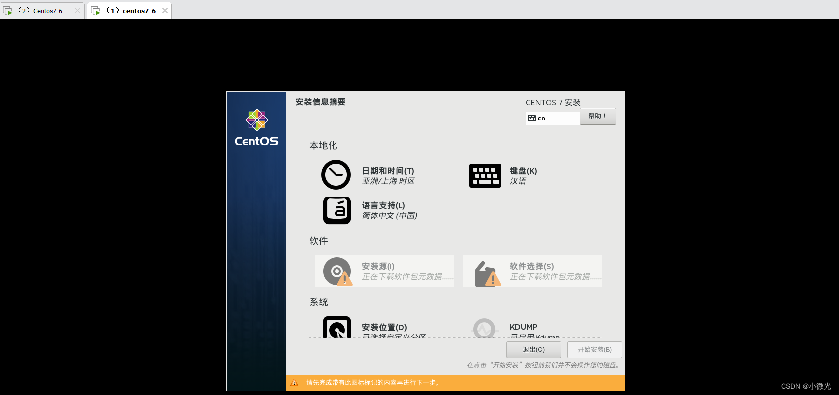
PXE efficient batch network installation

Navigation related messages

线程安全问题详解

Ulcl function --5gc

Wireshark IP address domain name resolution

Robot navigation
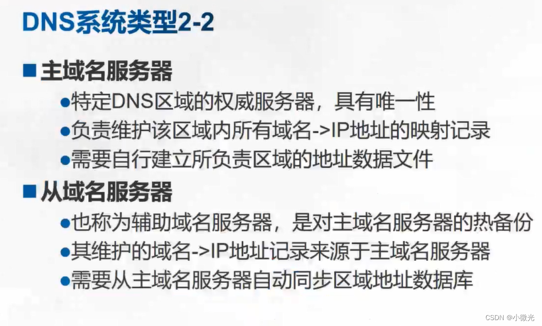
DNS domain name resolution service
随机推荐
兼容性测试知识点
Launch file of ROS operation management
Programming learning records - Lesson 8 [array and design Gobang, minesweeping game]
bug分类及缺陷和csv文件测试
Programming learning record -- recursively solving the tower of Hanoi problem
装饰器函数与类装饰器的使用
反射器中getattr,hasattr,delattr,setattr的使用
Basic knowledge of English: Rules for the use of non predicates Part 1
接口测试概念及Postman工具简介使用
PLL of IP core
Robot navigation implementation
About the use of TestNG related tags
gradle的安装配置及使用
Unit integration (grounding) test
regular expression
测试基础概括
Interpretation of unity desktop version 7.6
PXE高效批量网络装机
Basic operation of database on terminal
Programming learning records - Lesson 7 [functions]